Showing posts with label hill fort. Show all posts

Thursday, 18 February 2021

Caer Bach Hill Fort, Hut Circle, and Cairns, Llangelynin

Caer Bach is a small prehistoric hill fort situated at the end of Tal y Fan, looking out over Dyffryn Conwy, with good views up and down the valley. It can be easily approached by driving up the road to Llangelynin Old Church and parking on the small concrete area there, then walking along the footpaths to its location. During this current lockdown, though, I walked from home up to the west end of Tal y Fan, and along the higher footpath past Pen y Ffridd to the fort at the east end of the mountain.

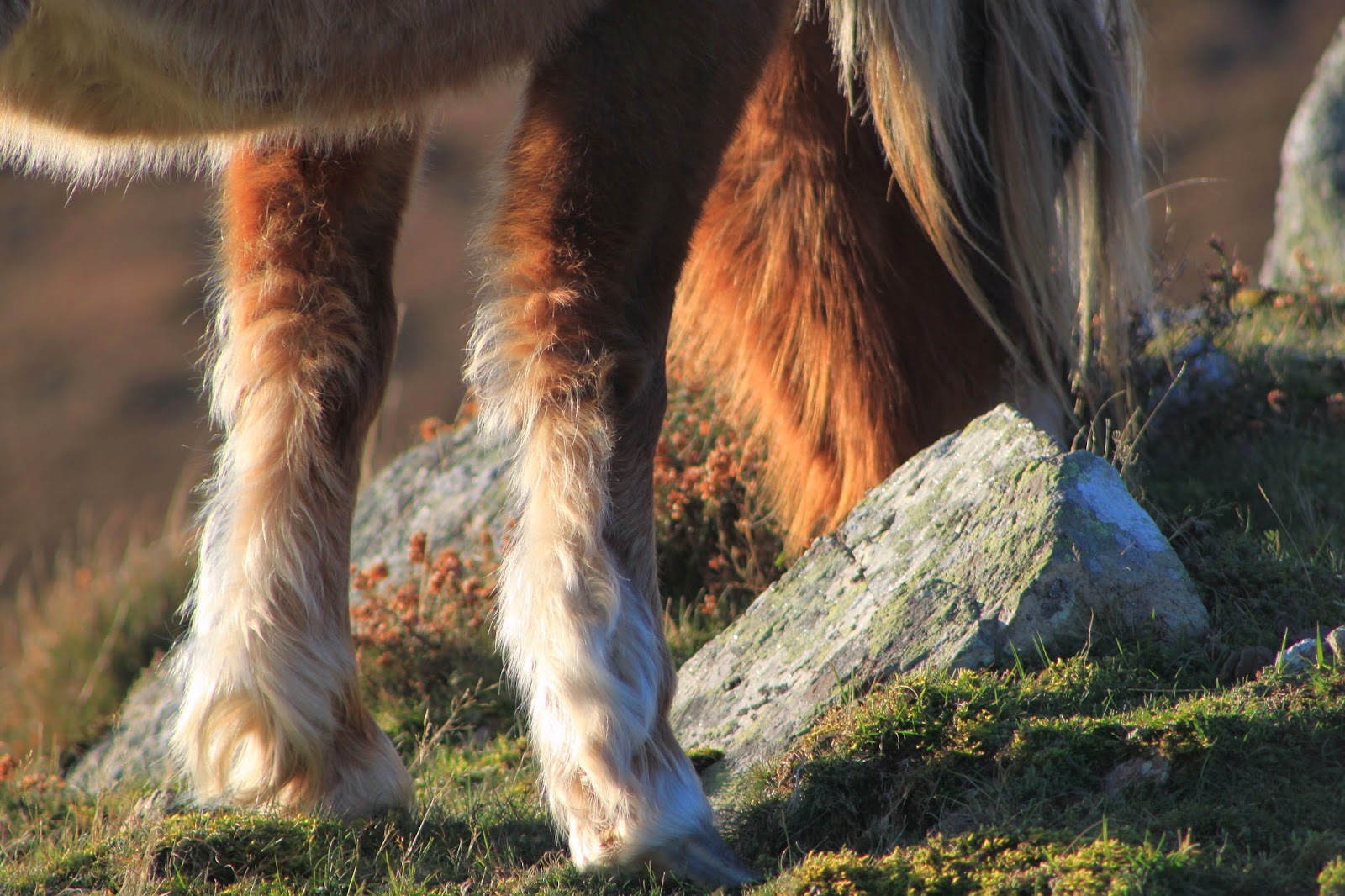
Often there are Carneddau ponies grazing about the fort's sides, along with the ubiquitous Welsh mountain sheep. The fort is at Ordnance Survey grid reference SH 7442 7297.

A very short panorama from the fort can be seen here


Caer Bach looks almost like an entirely human-made mound on the land, but I think it's mostly human sculpting of a pre-existing rise. Coflein lists the fort as 'prehistoric,' but doesn't narrow this date down at all. Heneb mentions that a post-Roman date may be possible, which would mean it was later than the fort at Pen y Gaer, and it would have been Pen y Gaer and Cerrig y Ddinas guarding the broad entrance to Bwlch y Ddeufaen.


Approaching the fort from the south west, the ditch and bank are more just a shallow platform and slope. 

I have grown up very familiar with the larger iron age hill fort, Pen y Gaer, on the other side of the entrance to the pass of Bwlch y Ddeufaen, but it was only recently that I found out this little place existed. It's not obvious on the hill like Pen y Gaer. Instead of crowning the top of a hill it sits on a tiny rise on the land between higher peaks, and is very hard to pick out on the skyline from a distance.


Looking back to the north west, the contours of rise-plateau-rise are fairly easy to see. The east end of Tal y Fan rises up behind the fort.
 

Coflein says the entrance to the fort is on the south side, and I think this is probably it. This corresponds with the entrance marked on the diagram on the Heneb site.


Standing in the fort entrance, looking towards the rocky hill of Craig Celynin in the east. A little further east, Cerrig y Ddinas is an iron age hill fort, atop another rocky hill.


The remains of the much robbed out inner wall.


The place is scattered with quite a few rocks and boulders, some of which might be the natural bedrock coming through. I wonder about the human hands that would have brushed over these rocks, the children who climbed on them. 


This single large recumbent stone gives me similar feelings. I like to sit here thinking that a few thousand years ago people may have sat here too, talking together. Perhaps the view wouldn't have been the same when the defensive wall was intact, but the stone can't have changed much. 


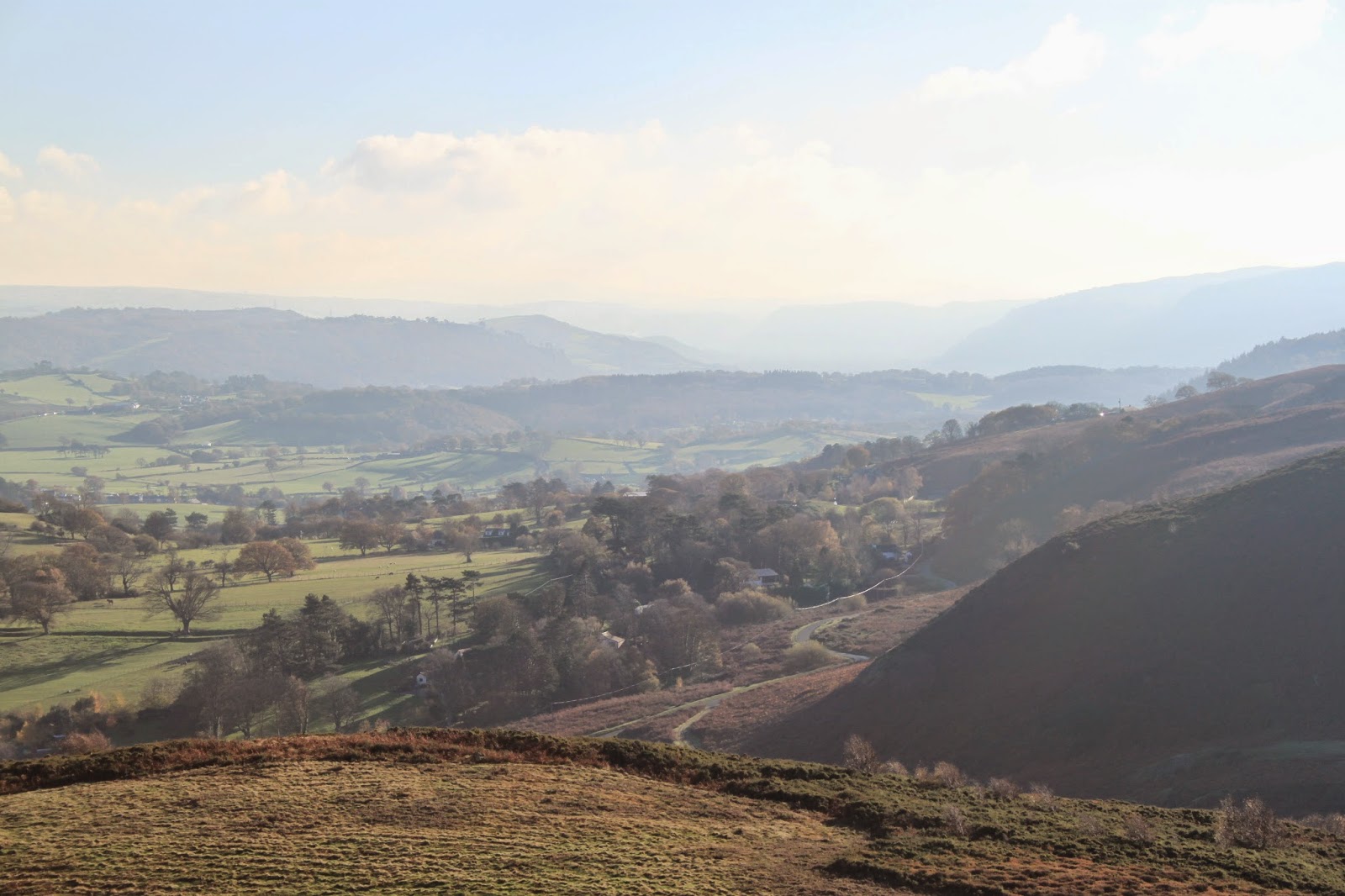
Looking south up the valley, with the Afon Conwy a silver line in the distance. 
 

Perhaps the larger stones in this wall have been robbed out to help build the stone walls that thread across the landscape. The wall is described by Coflein as being between 4-5 metres wide, and it must have taken a huge amount of time and effort to build. I wonder how long the wall stood after the place was abandoned. 
 

Looking across the top of the hill fort to the east end of Tal y Fan. Coflein states that a 'hut circle can be traced against the inner face of the NW side of the inner enclosure,' but I haven't been able to make it out. It is shown in the diagram on the Heneb site.


The north side of the fort is defended with a bank and ditch which are still very clear. Coflein says that the bank reaches a maximum height of ten feet.


Looking north-east, the rocky hill of Craig Celynin rises up to partly block the view of the valley. Beyond Craig Celynin is the rather smaller hill of Cerrig y Ddinas, with its iron age fort remnants. I don't know why the peoples who built the two forts decided not to use Craig Celynin for their base. Perhaps Caer Bach is less exposed. Perhaps it's more strategically placed. Cerrig y Ddinas, certainly, is in a great place looking right out over the valley, the last great hump of rock before the land plunges to the valley floor, like Pen y Gaer on the other side of this wide opening to the Bwlch y Ddeufaen pass through the mountains. 


Down in the ditch behind Caer Bach, looking north-east. Probably a certain amount of the banks on either side have eroded down into the ditch, so originally the place would have been more formidable to attack. Get past the ditch and bank and you still have the stone wall to storm. In the post-Roman era, if this is the date of the fort, perhaps they would have been defending themselves against other local people, or perhaps against the first incursions of Scandinavians and Germanic peoples that began as a result of general westward migration through Europe.


Looking south-west from the same place. The ditch becomes a little more shallow and eventually smooths out as you walk around to the front of the fort. Coflein mentions a 13th-14th century mediaeval house platform in poor condition cut into the edge of the fort on the south west side, but I didn't look for evidence of this. Another mediaeval house platform is listed slightly to the north east of the fort.
 

There is a hut circle here outside the fort, on the south west side, which I have found in the past, but couldn't make out today, in the bitter cold.


Looking down on Caer Bach from a little further up the slope of Tal y Fan. 


On another walk, in August 2020, I did find the hut circle outside Caer Bach, and spent some time dotting the slightly raised remains with sheep's wool to make it more visible. The circle is marked on Coflein as being at Ordnance Survey grid reference SH 7436 7293, and classed as Roman, Iron Age, which could make it a little earlier than the fort if the Heneb date suggestion is correct. It is just visible as a faint ring in satellite photos. 


A wide angle shot of the hut circle, looking north. 


The rim around the back of the hut circle can be made out raised above the interior, in the top third of this photo, with the curve coming around into the foreground to the right.


From the edge of the hill fort, the hut circle, looking west. 


The hut circle can just be made out to the middle left of the photo, with the hill fort rising above it to the right. 


This seems to be the entrance into the hut, a distinct dip in the rim. 


Without the sheep's wool the site is much harder to see. 

To the north of the fort Coflein mentions a Bronze Age kerbed cairn, but I haven't looked for this.
 

A little way west from the fort, just to the south of the track towards Cae Coch and Bwlch y Ddeufaen, are four prehistoric cairns. They are arranged parallel to the track, three in a row, and one standing a little north of them, closer to the track, directly in front of the centre cairn. The grid reference of the centre cairn is SH 7430 7260. I think this is the Coflein reference, although the site mentions five cairns and the rather imprecise grid reference of SH 742 726 centres a little north of the track. The site dates them as Bronze Age, but doesn't specify a purpose to the cairns.

On the Megalithic Portal the cairns are named, Ddwyffrwd Cairns, and characterised as a barrow cemetery.


This western cairn is the easiest to see as a slight rise and parch mark under the grass. The second and third are just visible in this photo beyond and to the left, under patches of low gorse.


The westernmost cairn again. 


The central cairn has small gorse bushes on it but is still quite easy to see. 


The third, easternmost cairn, is the hardest to make out under its crown of gorse. 


Looking south west across the central cairn.


The fourth cairn, closer to the track, is a little like the first, bare of gorse and just visible as a little discoloured rise in the land.


Wednesday, 19 November 2014

Conwy Mountain, Conwy Valley

Today was a beautiful winter's day, with a clear blue sky and brilliant sunshine, so we decided to walk up Conwy Mountain, or Mynydd y Dref. I've only been up it once before, earlier this year. The mountain always seemed rather strange to me, a bit alien and different from the mountains I'm used to further up the valley. It always seems a very red place, often covered in the red of dried bracken, with a different ecology than the hills further inland, and a lot of the slopes around there are covered in scree.

To my shame, after living here for thirty years, I didn't know until that first trip up the mountain this autumn that there was an Iron Age hillfort, Caer Seion, up there. Looking at the aerial view on the link here I think there's a lot more to see than we saw today. It's always hard to get a grasp of these things from ground level, but we explored the most visible bit. It must have been an amazing place to live, with practically 360 visibility, up above the sea.

There used to be another hillfort on top of Penmaenmawr mountain very nearby, one of the largest in Europe, but horrifyingly this was entirely quarried away by the 1920s. I did wonder standing up on Conwy Mountain if the ghosts of the residents of Conwy Mountain hill fort look across at Penmaenmawr in smug satisfaction. Their hill fort is still there, even with some of the beautiful dry stone walls still erect. You can read the Royal Commission summary of Penmaenmawr hillfort here. (The Conwy Mountain summary is here.)

It's a fairly easy walk up the mountain from Sychnant Pass, taking you up a well maintained track which is a farmer's driveway (I feel sorry for the farmer), and then onto paths across grassland. The ground never gets very steep but when you reach the top, with views up the valley to the south, across to Llandudno and the Great Orme in the north, towards the Denbigh Moors in the east, and towards Anglesey and Puffin Island in the west, you really feel like you've achieved something. In the summer people paraglide from these hills, and you can see why.


We started the walk off from the small car park at the top of Sychnant Pass, which is a rather steep pass through the mountains from Conwy to Dwygyfylchi. It can feel rather scary sometimes to drive along, especially before they fixed the wall.

The view up the Conwy Valley from the edge of Conwy Mountain. You can see the valley sides becoming steeper and closing in up towards Dolgarrog and Trefriw. The floor of this glacial valley is broken up with smaller hills.

A wider angle view up the valley, looking much flatter than it does in real life.

Looking west towards Penmaenmawr along the coast.

Another rather misty look up the valley.

From the side of the mountain you get a wonderful view of Conwy, and you can see where it gets both its English name, Conwy Mountain, and the Welsh name Mynydd y Dref (Mountain of the Town.)

Information board on the side of the mountain.


The first glimpse of the ruined fort walls. The information board says they would have stood about three metres high with a walkway with a chest high stone wall on top, which is somewhat reminiscent of the town walls below that were built almost a thousand years later by the English invaders. The entrance at the right is still very striking. I think it's the entrance shown towards the left on the diagram above.

Large stone marking the end of the wall, I think.

I'm used to the hill fort on Pen y Gaer, my 'home' hill fort, which is fairly ruined, so it's amazing to see the wall intact here, with such dressed looking stone.

Closer up on that wall. What amazing workmanship. Just the sheer amount of stone up here must have taken hours to collect.

The other side of that entrance.

The residents had a wonderful view. I imagine field patterns and the amount of trees has changed, but the contours of the land would have been the same.

The light was beautiful and golden, and not too cold. In this weather living on top of a mountain in November seems viable.

Looking towards the western end of the fort.

Looking more north-west, the view out to sea.

From here the Great Orme, another site of great prehistoric activity, is clearly visible.

The light was beautiful on the sands below.


A rather older information board attached to one of the rocks. Unfortunately the writing is faded and in the majority unreadable.

You can get an idea here of just how much stone must have been transported up the mountain to make these walls.

The tide is out in the Conwy estuary, with the Great Orme and Llandudno beyond. One of the area's many caravan parks is below.


The walls, the view up the valley, and Conwy.

Looking down over that smaller enclosure on the outside of the walls.

A clearer view of the estuary, and the Conwy Golf Club in the foreground.

In the distance some of the quarrying works are visible, I think on Penmaenmawr Mountain, the site of that very important but destroyed hill fort.

The quarry is still working today, the mountain having been quarried since the Neolithic age. You can see some of the buildings catching the light.

The views really are far-reaching. Far in the distance is Anglesey, and just in front of it, Puffin Island, or Ynys Seiriol.

On the way off the mountain the dog was very happy to find a small pool to wallow in.

Then we caught a sighting of two Carneddau ponies, a breed of horse unique to the mountains of Snowdonia. People are currently trying to prove the genetic importance of these horses in order to have them exempted from rules requiring all horses to have passports (a measure introduced in Europe to stop them entering the human food chain). These are wild horses, but under these regulations are assumed to belong to the landowner.

A bit of tail.

I love these horses, pretty much the same as the Welsh Mountain Ponies (but genetically unique. Important to remember.)

A bit of leg...

Horse's head.

A lovely view with the sun behind.

Tail in the sunlight.

A bit more tail.

They must spend a lot of time eating...

I think this one was young, maybe a yearling. It was quite small.

Pretty little pony.

The colour the coat turned in the sunlight was amazing.

Still eating...
And a little more eating...

Yet more eating...

And so we headed home...