Today was a beautiful winter's day, with a clear blue sky and brilliant sunshine, so we decided to walk up Conwy Mountain, or Mynydd y Dref. I've only been up it once before, earlier this year. The mountain always seemed rather strange to me, a bit alien and different from the mountains I'm used to further up the valley. It always seems a very red place, often covered in the red of dried bracken, with a different ecology than the hills further inland, and a lot of the slopes around there are covered in scree.
To my shame, after living here for thirty years, I didn't know until that first trip up the mountain this autumn that there was an
Iron Age hillfort, Caer Seion, up there. Looking at the aerial view on the link here I think there's a lot more to see than we saw today. It's always hard to get a grasp of these things from ground level, but we explored the most visible bit. It must have been an amazing place to live, with practically 360 visibility, up above the sea.
There used to be
another hillfort on top of Penmaenmawr mountain very nearby, one of the largest in Europe, but horrifyingly this was entirely quarried away by the 1920s. I did wonder standing up on Conwy Mountain if the ghosts of the residents of Conwy Mountain hill fort look across at Penmaenmawr in smug satisfaction. Their hill fort is still there, even with some of the beautiful dry stone walls still erect. You can read the Royal Commission summary of Penmaenmawr hillfort
here. (The Conwy Mountain summary is
here.)
It's a fairly easy walk up the mountain from Sychnant Pass, taking you up a well maintained track which is a farmer's driveway (I feel sorry for the farmer), and then onto paths across grassland. The ground never gets very steep but when you reach the top, with views up the valley to the south, across to Llandudno and the Great Orme in the north, towards the Denbigh Moors in the east, and towards Anglesey and Puffin Island in the west, you really feel like you've achieved something. In the summer people paraglide from these hills, and you can see why.
 |
| We started the walk off from the small car park at the top of Sychnant Pass, which is a rather steep pass through the mountains from Conwy to Dwygyfylchi. It can feel rather scary sometimes to drive along, especially before they fixed the wall. |
 |
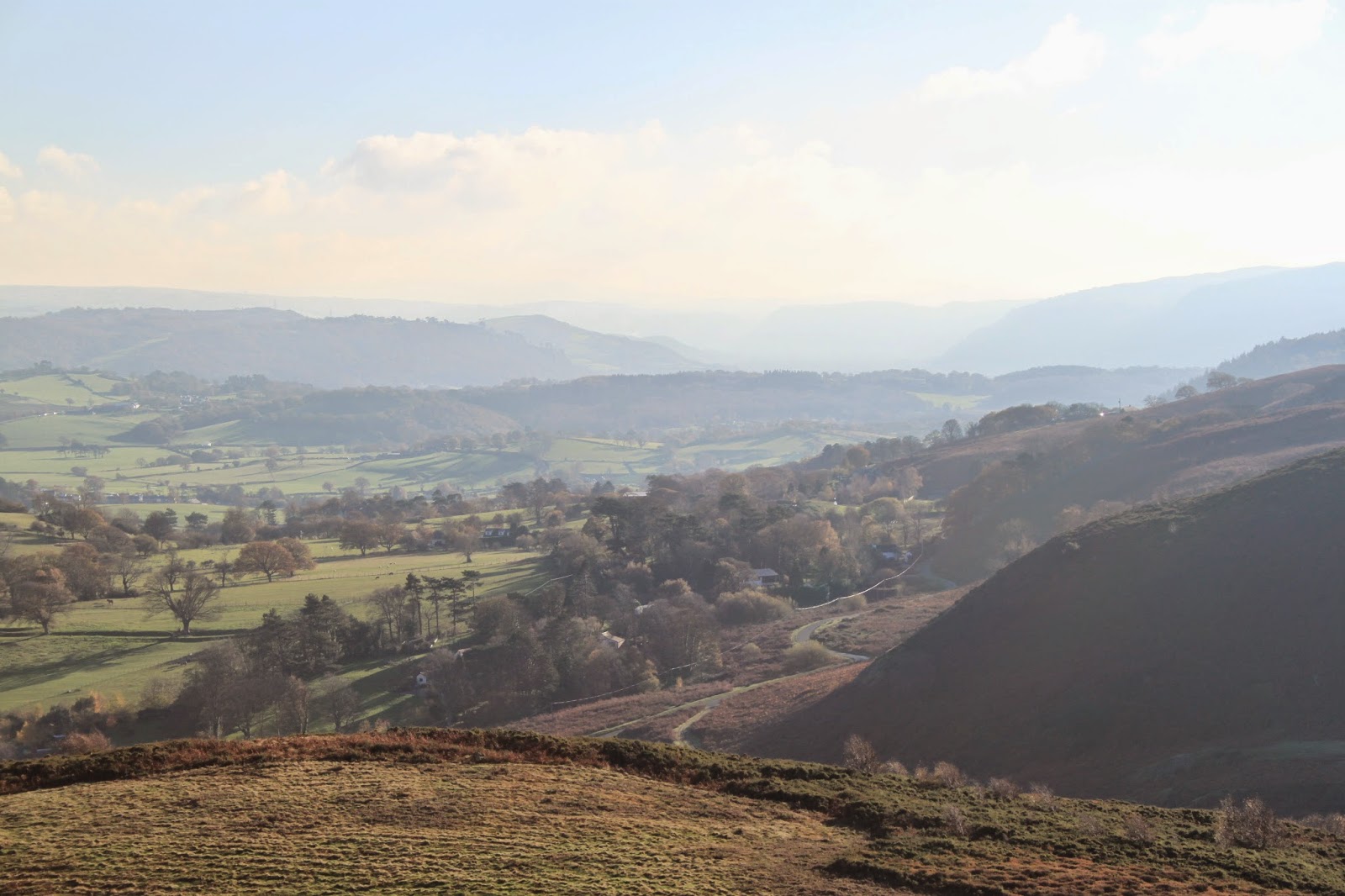
| The view up the Conwy Valley from the edge of Conwy Mountain. You can see the valley sides becoming steeper and closing in up towards Dolgarrog and Trefriw. The floor of this glacial valley is broken up with smaller hills. |
 |
| A wider angle view up the valley, looking much flatter than it does in real life. |
 |
| Looking west towards Penmaenmawr along the coast. |
 |
| Another rather misty look up the valley. |
 |
| From the side of the mountain you get a wonderful view of Conwy, and you can see where it gets both its English name, Conwy Mountain, and the Welsh name Mynydd y Dref (Mountain of the Town.) |
 |
| Information board on the side of the mountain. |
 |
| The first glimpse of the ruined fort walls. The information board says they would have stood about three metres high with a walkway with a chest high stone wall on top, which is somewhat reminiscent of the town walls below that were built almost a thousand years later by the English invaders. The entrance at the right is still very striking. I think it's the entrance shown towards the left on the diagram above. |
 |
| Large stone marking the end of the wall, I think. |
 |
| I'm used to the hill fort on Pen y Gaer, my 'home' hill fort, which is fairly ruined, so it's amazing to see the wall intact here, with such dressed looking stone. |
 |
| Closer up on that wall. What amazing workmanship. Just the sheer amount of stone up here must have taken hours to collect. |
 |
| The other side of that entrance. |
 |
| The residents had a wonderful view. I imagine field patterns and the amount of trees has changed, but the contours of the land would have been the same. |
 |
| The light was beautiful and golden, and not too cold. In this weather living on top of a mountain in November seems viable. |
 |
| Looking towards the western end of the fort. |
 |
| Looking more north-west, the view out to sea. |
 |
| From here the Great Orme, another site of great prehistoric activity, is clearly visible. |
 |
| The light was beautiful on the sands below. |
 |
| A rather older information board attached to one of the rocks. Unfortunately the writing is faded and in the majority unreadable. |
 |
| You can get an idea here of just how much stone must have been transported up the mountain to make these walls. |
 |
| The tide is out in the Conwy estuary, with the Great Orme and Llandudno beyond. One of the area's many caravan parks is below. |
 |
| The walls, the view up the valley, and Conwy. |
 |
| Looking down over that smaller enclosure on the outside of the walls. |
 |
| A clearer view of the estuary, and the Conwy Golf Club in the foreground. |
 |
| In the distance some of the quarrying works are visible, I think on Penmaenmawr Mountain, the site of that very important but destroyed hill fort. |
 |
| The quarry is still working today, the mountain having been quarried since the Neolithic age. You can see some of the buildings catching the light. |
 |
| The views really are far-reaching. Far in the distance is Anglesey, and just in front of it, Puffin Island, or Ynys Seiriol. |
 |
| On the way off the mountain the dog was very happy to find a small pool to wallow in. |
 |
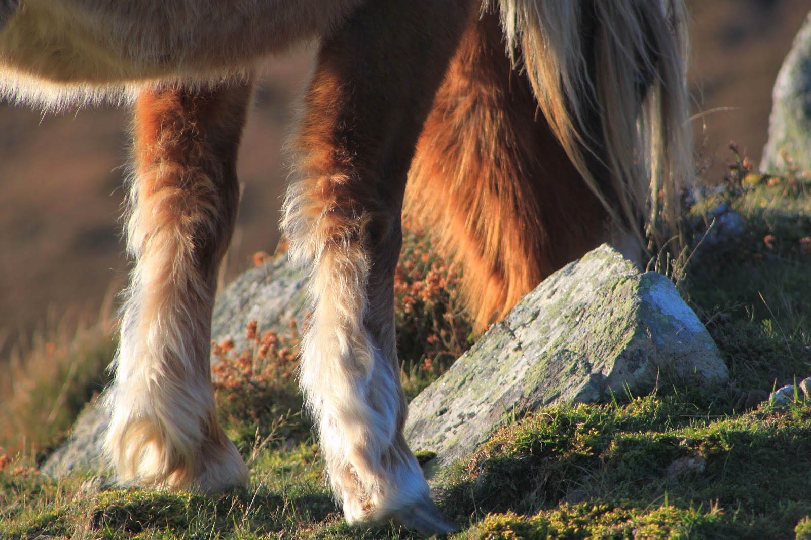
| Then we caught a sighting of two Carneddau ponies, a breed of horse unique to the mountains of Snowdonia. People are currently trying to prove the genetic importance of these horses in order to have them exempted from rules requiring all horses to have passports (a measure introduced in Europe to stop them entering the human food chain). These are wild horses, but under these regulations are assumed to belong to the landowner. |
 |
| A bit of tail. |
 |
| I love these horses, pretty much the same as the Welsh Mountain Ponies (but genetically unique. Important to remember.) |
 |
| A bit of leg... |
 |
| Horse's head. |
 |
| A lovely view with the sun behind. |
 |
| Tail in the sunlight. |
 |
| A bit more tail. |
 |
| They must spend a lot of time eating... |
 |
| I think this one was young, maybe a yearling. It was quite small. |
 |
| Pretty little pony. |
 |
| The colour the coat turned in the sunlight was amazing. |
 |
Still eating...
|
 |
| And a little more eating... |
 |
| Yet more eating... |
 |
| And so we headed home... |


You live in such a beautiful place!! So many of your photos remind me of classic watercolor landscapes. And I love it when you include the information boards so that we can get a feel for the area. The top of that mountain must have been a glorious location to have lived. The views are stunning.
ReplyDeleteLove the horses. Do you know if they're small because of their genetics? Or is it because the quality of their food is poor? I know the latter is the main reason that the wild "ponies" on Assateague Island (off the coast of Virginia, in the US) are small. Genetically, they're full-size horses, but the scrub brush that they eat is not very nutritious and so they never grow to full size. Whatever the reason for their size, they're lovely. The long fur is wonderful. I've never seen shaggy horses before! Thanks for taking us along on your adventures!
Thank you <3 It's a lovely place up there and I wish I'd started exploring it years ago.
DeleteI assume the horses are small because of their genetic heritage - at least, that the poor conditions led to the evolution of smaller, hardier stock. The Welsh Mountain Ponies that people keep domestically are small too.