For a period in the summer these trees on the right looked quite striking, as the leaves on one of the three trees were quite a different shade from the leaves on the others. The three trees, from a distance, look like one.
The corner of the settlement, surrounded by a sea of nettles. The weather may be worse in the winter, but it's worth waiting for the nettles, so ubiquitous in these places, to die down.
As we see with so many of these houses, a low wall runs along in front of the property, separating the house from the fields.
In the northernmost cell, the space is filled with nettles and gnarled wood, making it hard to make out the structure, but it appears to be an outbuilding.
The doorway into this first outbuilding. You can just make out a hole in the stone to the left of the doorway, presumably for a hinge or bolt. A bolt seems more likely, at that height.
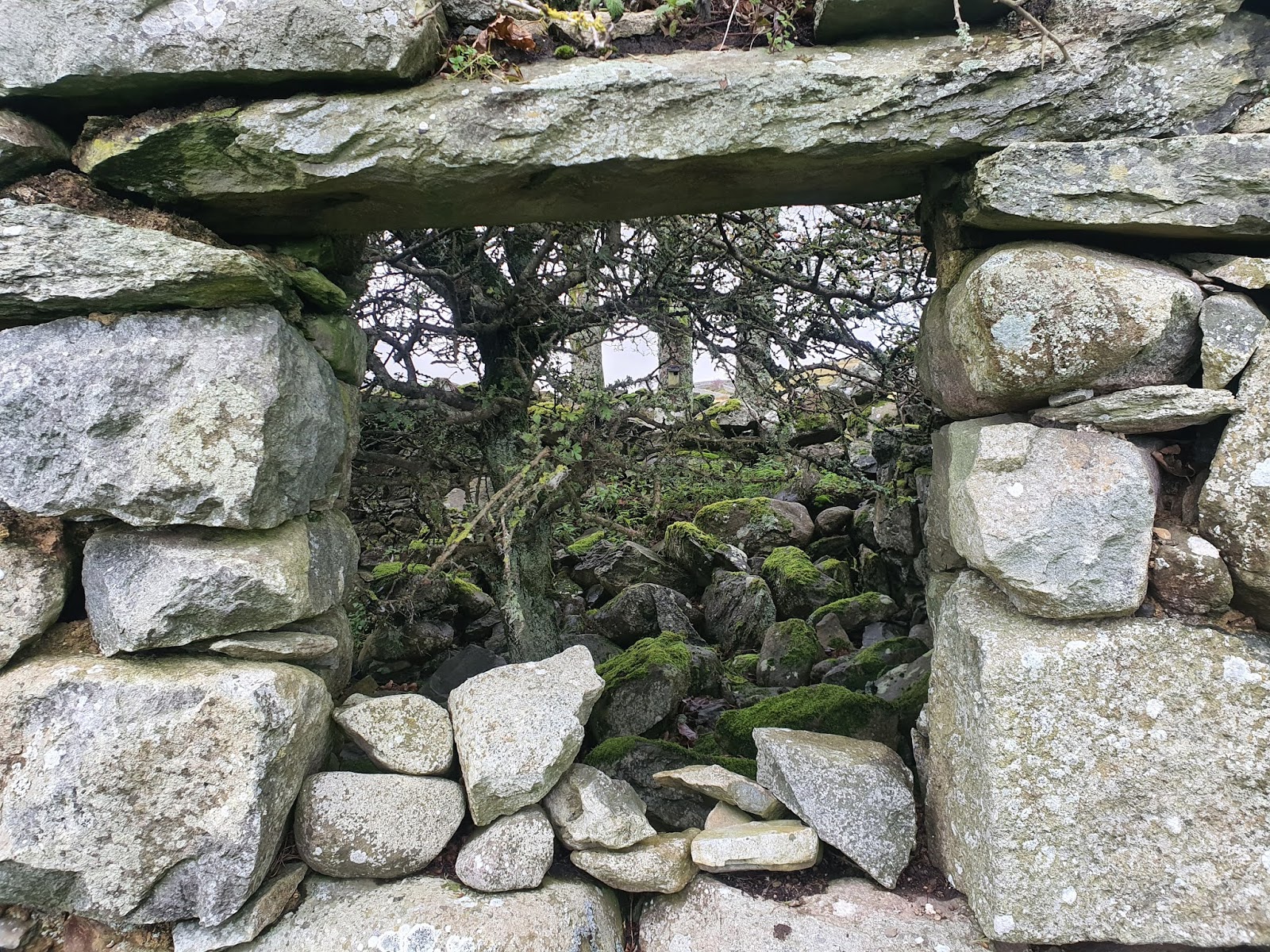
Looking through the doorway into the first outbuilding.
The next cell is equally inaccessible, this time guarded by a dog rose, vibrant with rosehips.
One of the windows into the main farmhouse, which shows signs of having been blocked up at one time. Presumably when these places were still roofed, but uninhabited, farmers blocked up the windows so as to make the buildings more weathertight.
The corner of the farmhouse, showing big, solid, squared-off stones.
Under the window into the main room is an impressive long stone, which looks as if it would have been very useful as a lintel.
The doorway into the main house, partly blocked by a broken gate, and the second window to the left.
Looking along the length of the house, from the left of the main door, to another door in the next cell.
The lefthand window also shows signs of having been roughly blocked up with stones which have since tumbled down.
Inside the main farmhouse are signs of there having been two rooms. This photo was taken standing in the main room, looking over the tumbled dividing wall. This small second room has a low fireplace in the north wall.
The hole of the chimney can just be made out above the stone lintel of the small fireplace.
Two holes in the lintel presumably would have held ironwork or wooden pegs for hanging things on. The fireplace is probably larger than it seems, due to the amount of rubble on the floor.
Looking to the south, the main fireplace can be seen at the southern end of the room.
To the left, inside the fireplace, is this impressive bread oven, with a few bricks on the right and possibly a clay tile on the floor. At a push (and with a deathwish) I could probably have fitted inside, rolled up into a ball.
On the left, you can just see the entrance to the bread oven, with the bricks at the back.
Left and right on the stone beam are these drilled holes, as in the smaller fireplace, probably for pegs or ironwork for hanging things from.
The interior of the house is so filled with tree growth that it's hard to manoeuvre, and to take photos. This is looking out through one of the windows, through an elder tree.
On the southern end of the farmhouse are more cells, well built and in relatively good condition. Perhaps this was a barn.
Looking to the south, from the door at the north end of the possible barn.
A doorstep is still in situ, with a few stone flags just inside the doorway.
At the other end of the barn cell are joist holes, and another doorway (blocked up) on the left. Despite the joist holes I saw no sign of windows, and, if the roof ridge height is original, this floor would have had a very low ceiling. It seems more likely that this building was for storage and livestock than living quarters. Perhaps there also used to be a partition across the middle, considering the doors at either end. There are no joist holes in the north end of the building, and no sign of a fireplace.
Some of the stone flags just inside the doorway.
Another doorway leads from the back of the barn into the small back yard.
The north end of the barn, with no sign of joist holes.
Looking back at the northern doorway and the end wall.
The southern doorway, blocked up, and the southern wall with joist holes. I don't know what the purpose is of the metal pipes fitted across the end of the building.
The small back yard behind the house; again, typical of these cottages.
Looking towards the southern end of the back yard, with the building to the left.
This tree seems to lean heavily against the ruined wall, pushed by the prevailing winds.
Coming around the southern end of the building, the land is patched with reeds. The view out over the valley might not have changed much, at first glance, since people last lived here.
Looking north, from the southern end of the range.
This little end cell is quite ruined, and it's hard to tell if it were ever a full height building or just a pen.
The blocked up southern doorway is more obvious from outside.
Looking back across the sea of nettles along the front of the buildings. Tal y Fan is crowned with cloud.
I wonder if this huge, long boulder in the wall at the end of the range had always been there, since before the house was built.
The house is brushed over by larch branches. Larch seems to be a popular tree around these farmsteads, I'd guess because they're fast growing so quickly provide shelter, or quickly provide a source of fuel.
Looking back along the back yard.
At the south end of the range is this small, square field. Would crops have been grown in this enclosure, perhaps?
These three trees in the back yard make me think of the Three Graces of Greek mythology.
The Three Graces.
Intriguingly, someone has nailed a bird box to one of the trees.
Looking into the end of the house (left) and the southern barn (right) from the back yard. You can see a lack of continunity between the end wall of the house and the start of the barn wall.
Looking along the range from the back yard towards the northern end. Again, you can see a sharp break between the end wall of the house on the right and the outbuildings on the left, suggesting different dates of construction.
Part of the fence running from the gateway seems to be trying to escape down the hill. Maybe this is another casualty of the west wind.
Looking back to the house from the gateway by the road. From a distance I feel as though I can hear the sounds of life coming from the little dwelling.


No comments:
Post a Comment