In the end I made something of a horseshoe walk, leaving the car park at Eigiau to walk round Clogwynyreryr, then up and along Cefn Tal Llyn Eigiau and Gledrffordd, straight to Ffynnon Llyffant, then up Carnedd Llewelyn, before coming back and scrambling down to Melynllyn, past Dulyn, and back down Pant y Griafolen to the car park at Pen y Gaer, where my husband met me to save me the last mile or so home on the road.


We (Idiot No. 2™, and I) set off from the car park at Eigiau, after an ignominious send off involving a Land Rover that didn't bother to slow down as it passed us, covering myself, my husband, and son with muddy puddle water up to our shoulders.

This great stone guards the side of the trackway as you start to ascend around the side of Clogwynyreryr. I think the markings on it are beautiful.

Old sheepfolds lie below the trackway, which stretches back straight to the Eigiau car park.

Either side of the track around Clogwynyreryr, at Ordnance Survey grid reference SH 7250 6687, stand these two stones. I've always, half jokingly, thought of them as really bad gateposts. Coflein has them listed as part of a stone row of four stones, but assigns no date, and suggests they could have been fence supports.

We took the track around Clogwynyreryr, then cut up over rough ground to
get to the top of Cefn Tal Llyn Eigiau. As we climbed higher the views
over the Conwy Valley spread out to the coast, growing more and more
beautiful.

We got our first glimpse of Dulyn, the small, mysterious lake sheltered by ominous black cliffs. This lake has called to me all my life.

On the hillside opposite, not far down the Pant y Griafolen valley from Dulyn, the remains of a prehistoric settlement can be seen clearly on the ground. The settlement is at SH 7090 6670. Coflein has little to say of it. It also marks a settlement at SH 7092 6668, but assigns no date to it.

There are often wild Carneddau ponies - a distinct species native to this area - to be seen in these parts. These were some distance away, and I left them well alone.

The views widen the further you climb. The lake of Melynllyn is just becoming visible, to the left of Dulyn.

Melynllyn lies a hundred metres higher than Dulyn, at 630 metres (just over 2,000 feet). The names mean Yellow Lake and Black Lake respectively. Although the waters of Melynllyn aren't exactly yellow, they're certainly not as dark as Dulyn.
In the foreground a small building can be seen, associated with the Melynllyn Hone Quarry, which I visited on my way home from Carnedd Llewelyn.

The going is relatively flat once you reach the top of Cefn Tal Llyn Eigiau and pass onto Gledrffordd, although the land rises slowly before pitching up sharply to become Carnedd Llewelyn (Llewelyn's Cairn), in the centre of this photograph.

From Gledrffordd, you can see down into Cwm Eigiau. The waste tips of the Cwm Eigiau quarry are visible at the base of Pen yr Helgi Du (Peak of the Black Hound.)


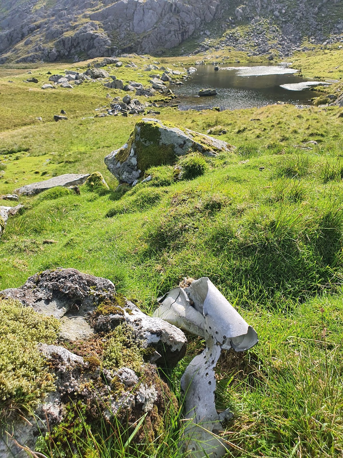
This second piece of wreckage, with windows, was nearby at SH 69620 64661. I don't think it's from the Canberra since I haven't been able to identify any similar windows on that plane.

A third scrap of wreckage at SH 69479 64640.

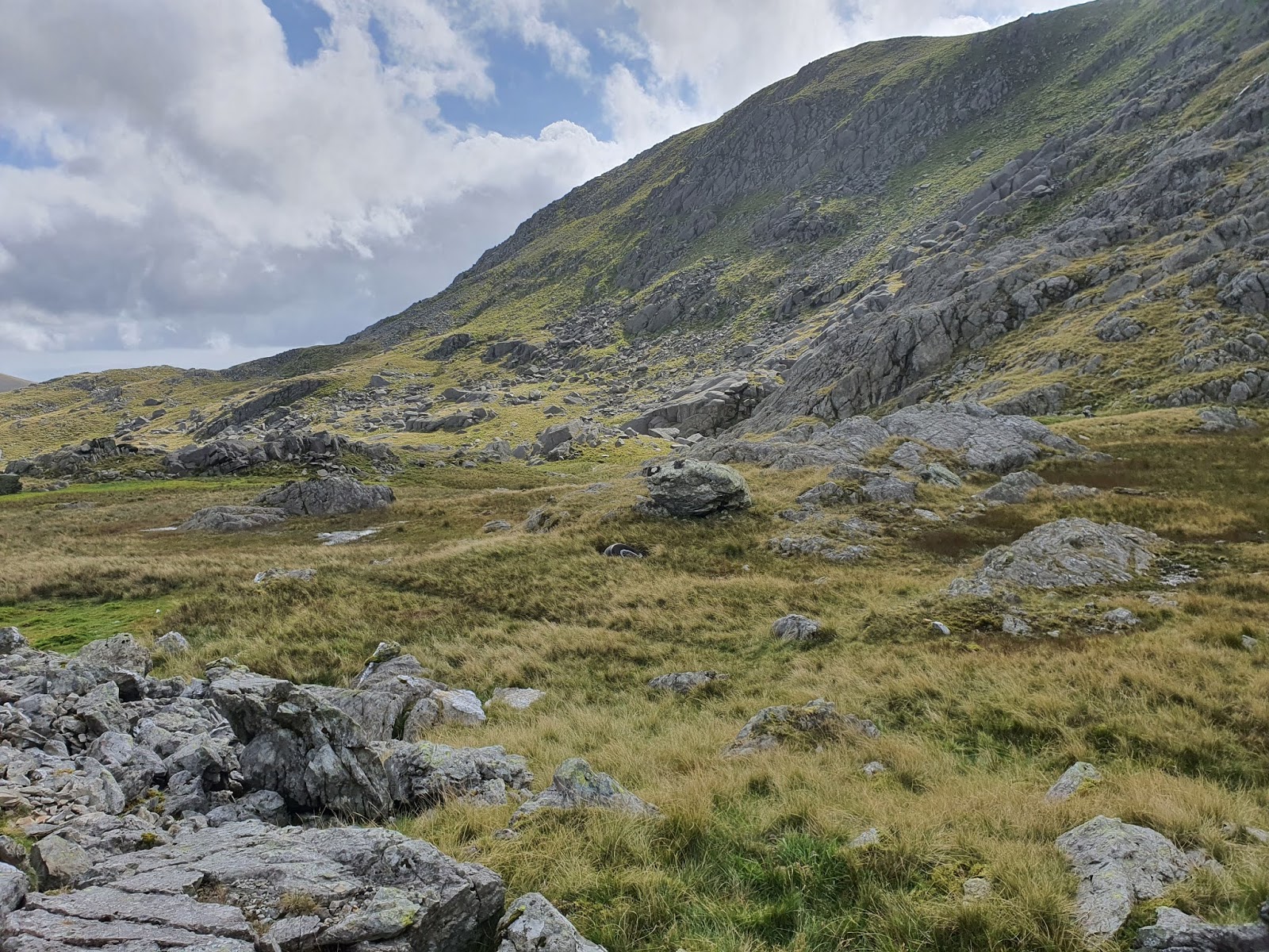
Finally, we were approaching the crags around Ffynnon Llyffant. When I was researching this walk I couldn't be sure if the lake was accessible without climbing, but, as it turned out, it was perfectly easy to get to.

Whenever you walk in these places, birds twitter and fly up from the grass. I saw this little one just sitting on a rock up ahead, seemingly uncaring of my approach.

The first of the little lakes appears. This isn't Ffynnon Llyffant, but a smaller pool in front of it.

Ffynnon Llyffant lies in a little depression where a number of mountains come together, below the steep slopes of Carnedd Llewelyn. Ffynnon means well, but also spring, which seems more likely in this context. Llyffant means frog or toad. (In my language learning experience - Welsh, Russian, and Old English in the main - I find it's better to understand the sense of a word than grasp for a direct cognate in English. Perhaps ffynnon means well or spring, but essentially it means ffynnon.)
On my approach to Ffynnon Llyffant I saw the first piece of wreckage definitely associated with the Canberra; a wheel lodged in a small pool, in the centre of this photograph.

The wheel is a strange and eerie sight in this idyllic context. I will cover the wreckage more fully in a separate post, with grid references for the locations of various pieces.

Ffynnon Llyffant may be the highest lake in Wales, at about 815 metres, but it's very small. I'm not sure how big a body of water needs to be to be classed as a lake, and I've had trouble finding out what the highest lake in the UK is. Aircraft wreckage is scattered about the end and side, and in the lake itself.


Part of a jet engine at the north end of the lake. The plane, an early jet, actually crashed on the western side of the edge of Carnedd Llewelyn, but heavy parts like wheels and engines ended up on the eastern side, down in the lake.

Idiot No. 2™ had no sense of the solemnity of this crash site, or the natural beauty. She was just glad of the long walk.

A makeshift memorial has been scratched onto one of the aircraft panels. The crew of two were Flight Lieutenant William Albert Bell, aged 31, and Flight Lieutenant Kenneth Charles Frederick Shelley, aged 27. They both died on December 9, 1957, after finishing radar testing in the area. You can read more about the accident here.


Idiot No. 2™ surveys her surroundings.


Further up the hill the lake becomes a speck, with Cwm Eigiau to the left. It was a hard slope to puff up. The steepness isn't really evident in the picture.

Idiot No. 2™ is proud of her achievement. Apparently I was too out of breath to hold the camera straight.


Ffynnon Llyffant can be seen on the right, with the other little lake to the centre of the photo. In between is an area which probably becomes more of a pool in winter.


Up on Gwaun y Garnedd, between Foel Grach and Carnedd Llewelyn, this rock formation looks as if it burst through the ground by violence.

Gwaun y Garnedd is a very level platform before you ascend the last part of Carnedd Llewelyn. Gwaun can mean heath or moorland, but in this context it seems more to apply to a broad, flat land.


I encountered more Carneddau ponies up on this flat piece of land. One of them seems to be a foal.

This grey pony in particular was very curious about us. I got no sense of aggression from him; only a deep curiosity.

The grey came very close, with its white companion in tow, but was eventually spooked by Idiot No. 2™, who, naturally, behaved like an idiot.

Just over the edge of the hill I could see this amazing sheer sided mountain. Yr Elen, like Pen Llithrig y Wrach, seems to be sheer on one side but quite approachable on the other.

We climbed up a relatively steep slope of scattered stone to reach the flat top of Carnedd Llewelyn. It's rather surprising how flat it is on top. The preconceived notion of mountains like this is that they should have a peak.
The landscape up here seems like something from the moon or Mars, as if an alien planet had suddenly been grassed over. It's easy to imagine the scouring effects of deep time on the rocks of these ancient mountains, breaking them down inch by inch. Click here to read a short history of the geology of the area.

The actual summit of Carnedd Llewelyn is marked by a cairn. Without it, it might be hard to know exactly where the top is. Curiously, although it wasn't very windy on top of the mountain, when I climbed the extra few feet of the cairn I was almost blown back down.


Even though the summit was flat, the views were quite beautiful.

Some small distance from the cairn is a little circular shelter, giving a welcome break from the increasing wind.

The view from the eastern edge of Carnedd Llewelyn, out over the Conwy Valley in the far distance.

From this perspective you can see how high the summit is above Ffynnon Llyffant. The peak is 3,491ft (1,064m) above sea level.
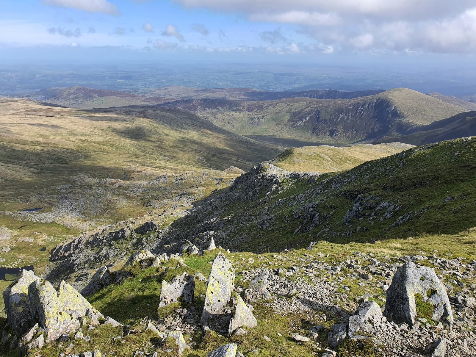
Looking down into the valley of Cwm Eigiau to the right. A cwm is a bowl shaped valley. The word has the same etymology as 'combe.' Beyond the closer hills you can see the Denbigh Moors rising on the other side of the Conwy Valley.

Over the flat moonscape top of Carnedd Llewelyn, the peaks of the further mountains seem to be trying to show Llewelyn how it's done.

Descending again, we crossed this loose rubble of small rocks. I saw a fell runner pounding past, straight across the top of Carnedd Llewelyn and down this side, barely pausing over this ankle-twisting terrain.

That impressive spiky peak of rock, which looks as if it were pushed up by force.

The walk along the ridge to the right is a rewarding and tough one, with scrambling in places up and down very steep slopes. Not recommended for small dogs like Idiot No. 2™. When I took our larger Idiot No. 1™ she didn't have too much trouble, but there is a small cliffy descent to get down at one point. Pen Llithrig y Wrach to the left is the last test after the up and down of the ridge.


Again, here it looks as if rocks were thrust up through the ground by force. They make me think of the spiky crown of a great giant queen, buried under the earth.

Melynllyn appears under the edge of the hill, with the scar of the small quarry on the right. Under this perfect sky the lake is more 'llyn glas' - 'blue lake' - than melyn.

I wasn't sure how realistic my plan was, looking at the contour lines, to cut down the side of the hill directly towards Melynllyn. Once I was there I could see that although it was steep, the slope was manageable.

Melynllyn, like so many of the lakes in this area, is a reservoir rather
than being totally natural. Sometimes I long for a lake that hasn't
been tampered with by humans. According to Wikipedia, 'a small dam was built at its northern end in 1887, but this was deliberately breached in 1970. The lake acts as a reservoir for the Llandudno area.'

There seem to be a couple of quarrying scars on the side of the hill. I don't know if the closer one is natural or human-made, but I think human-made.


Above the tip this gouge leads into the hillside. This doesn't lead to a tunnel, but only a shallow cave carved out in the rock. The life of the quarry was only about 50 years.


Not a lot remains of this building, and there don't seem to be any other remains nearby. Coflein (see link above) mentions remains of a winding house and a small barrack house, but I'm not sure what they mean, since this building is obviously the mill building, and I couldn't see any other remains.


The front of the building, facing east, with a gap through, which holds the small flywheel.


Up on the hillside between the lakes are more quarry workings, which are, confusingly, listed by Coflein under the heading of Melynllyn Hone Quarry as well as Dulyn Slate Quarry. Although Coflein is generally a useful site, sometimes it does get rather muddled.


The bothy is possibly associated with the Dulyn mine workings, but it's curiously hard to find out details about the place.

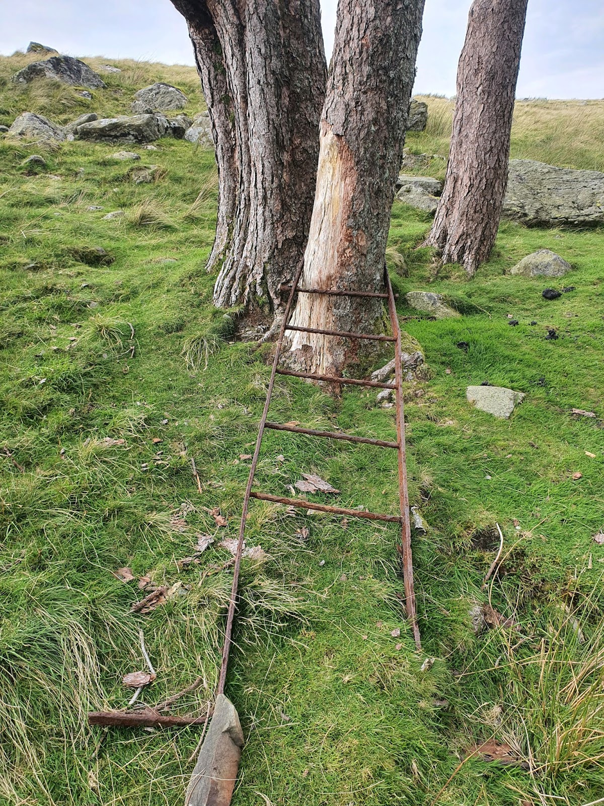
A little way down from the bothy is this little stand of trees, which has always intrigued me. Perhaps they were grown as fuel for the bothy, but they're relatively far away. Usually clumps of trees like this are associated with buildings. This is a good landmark in the valley, seen from a far distance.


About to cross what I think was the Afon Ddu, one of the more substantial streams coming off the mountainside.


If this is the Afon Ddu ('Black River'), it's an apt name.


The straightness of some of these mountain walls always astounds me. They represent astonishing skill.


We cut down past the little ruined hafod of Ffrith y Bont, where these curious stones are lined up near the wall (SH 7294 6819). It's listed on Coflein as a possibly prehistoric stone row, but the likelihood of it being contemporary with the farm is also mentioned. Perhaps it is ancient, but to me it feels more like something associated with the farm. I base this on nothing but a gut feeling. I did see a similar arrangement at another nearby hafod, with stones set in a line a few feet from the wall, although those ones were low and broad, not high and thin.

Looking back up towards Dulyn, with the sun setting behind the mountains, as I walked along the abandoned leat. This leat, in its unfinished form, stretches all the way to the dam partway up Afon Dulyn.


No comments:
Post a Comment