Not exactly a lost cottage, but a ruined building in the same setting as many of these cottages. This little building up on the mountainside above Rowen (at Ordnance Survey Grid Reference SH 7367 7040) is something of a mystery. It sits not far above the two White Harts, Isaf and Uchaf, which are rumoured to be drovers' inns, but doesn't seem to be associated with them. Early maps (included at the end of this post) show no tracks leading from the inns to this building.
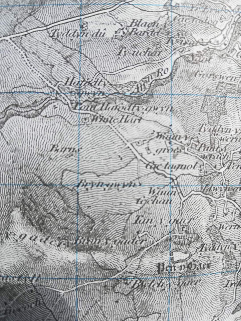
The road leading up to the building is a very straight, relatively new road. By new I mean, the road did not exist in its current form on the 1850 map, but does exist on the 1888-1913 map. The building is noted on the 1850s map, however, and the road at that time is a curving road that goes to the building and no further. On that map the building is marked as 'Barns.' The fact the road goes so deliberately to this building and nowhere else implies some importance, or at least some level of traffic beyond a farmer on foot or an occasional cart.
Discussion on a local Facebook page has established very few things about the place. The current straight road, which passes near the building but doesn't lead directly to it, is known by some as the Drum Road (Drum being the mountain it leads to) and to some as Ffordd Mynydd (Mountain Road, or, loosely, the road to the mountain.) The building is known as 'Y Stabl' (The Stable.) Varied suggestions were made as to what it might have been used for. A stable or barn, as the name suggests. A powder store for quarrying. A peat store, to keep the valuable fuel safe from theft. One local neighbour is sure it was a peat store, another is certain it's a stable for the White Hart Inn, which sits nearby.
None of these seem like very plausible suggestions, though, with the exception, perhaps, of the peat store idea. The building is not architecturally right for a powder store, and is far away from any marked quarries. It would seem an odd place to have a stable, well away from any other buildings or thoroughfares. Although it's close to the White Hart it's not nearly as close as it could be, and the road that leads to it doesn't come from the direction of the inn. Could it be a shepherd's hut? It seems unlikely simply because the building is so well built, with considerable investment in dressed stone and a very solid, lockable door. Also, there's no sign of fireplace or windows. The mystery of this building is that it just doesn't resemble nearby outbuildings around farmsteads, which are usually built with undressed stones, and it seems too expensively built to just be something raised by a local farmer.
The view of Y Stabl from the field behind. The back wall, end wall, and roof are all missing.
The front and corner of the building are built with large dressed stones, making the place look surprisingly substantial for such a small building in such an isolated spot.
From the front, the remains of the building look quite impressive, although the door to the right is now missing, along with the end wall.
Inside one of the rooms, signs of mortar remain, along with a fallen joist. There are no signs of either windows or a connecting door from this room to the next. Neither is there a sign of a fireplace.
From behind, this is the main room into which an impressive wood door with iron fittings leads on the other side. Because of the tree growth and the state of the walls, it would be neither safe nor easy to investigate more inside.
This is the best view that can be got of the wall inside this room. Perhaps in winter it would be easier to see, once the tree has lost its leaves.
In the other room, there are signs of a door leading into it from outside, in the end of the front wall. Only a single doorpost remains, though.
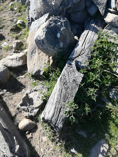
A fallen timber, along with other rubble.
An old iron gate, rusting on the ground.
The door, surprisingly, is still in good condition despite the ruin of most of the rest of the building. Built of substantial planks, it boasts impressive iron fittings and a keyhole, too.
This rather lovely keyhole, with the workings visible inside.
Another old piece of ironwork offering the opportunity to make the door even more secure with a padlock.
Hefty iron nails in the door, crossed by a strut of iron.
The closest of the two White Hart buildings is in the trees to the right of the photo; quite a distance away to make this a convenient stable.
The view from behind the building, looking towards Ffordd Mynydd and the mountains of Pen y Gaer and Pen y Gadair.
The very straight Ffordd Mynydd, stretching down to the lane below. No trace can easily be seen of the earlier curved road, either on the ground or on aerial photographs.
The 1850 map, which shows the building marked as 'Barns' at middle left, and a curving road leading to it.
The 1888-1913 map, now showing the straight road and no sign of the curving road, with the building marked just off the road, but with no name or designation applied. Image from Archiuk.


No comments:
Post a Comment