Showing posts with label Toll House. Show all posts

Wednesday, 23 December 2020

The Lost Cottages - Gatehouse, Caerhun Parish

This little place, the 'gatehouse,' or 'gateway to the mountain' seemed more a subject of local knowledge than historical fact, little more than scant memories passed on and remembered badly. It sits at the old entrance of the drive to Tyddyn Wern - the drive has since been rerouted to avoid the ford across the stream. The place poses more questions than it answers. Is it a gatehouse for Tyddyn Wern? It seems unlikely. Tyddyn Wern is one of the longer lasting, well established farms on this road, but it seems unlikely it would have a gatehouse. Could it have served to take some kind of tolls for people travelling up to the mountain and the important pass of Bwlch y Ddeufaen? Possibly, but there are at least three other routes up to the pass. Did they all have gatehouses, or was Ffordd Pant yr Iwrch, the road in question, the only one funded to keep in good order? 

What is undeniable is that the place has been in ruin for a very long time, with very little remaining but foundations. I've only found two references to it in the census, separated by twenty years. The house sits on the junction of the lane up to the mountain and the drive to Tyddyn Wern, at Ordnance Survey grid reference SH 7551 7023, but on the far side of the stream from the lane, so access would have been over the ford, which can be hard to cross at times in winter, and would have been even more torrential, perhaps, before the leat across the mountain was built, which reduced the flow of the stream. 


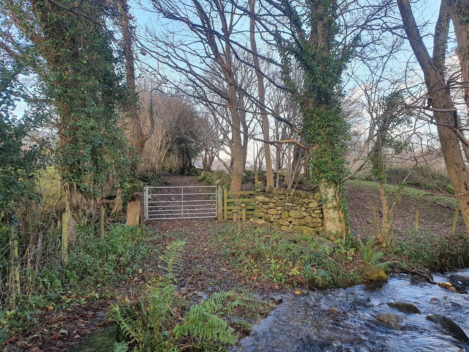
From the modern concrete footbridge over the stream, the driveway to Tyddyn Wern can be seen leading away through an avenue of small trees. The route is a public footpath.


Just to the right of the track, beyond the modern gate, lie the remains of the gatehouse.


The track can be seen leading straight through arched trees, mostly hazel, with the building on the right. 


This large stone seems to have been used as a gatepost at one time. 


There are quite a few holes in this stone, which is a lot of effort to hang a gate. 


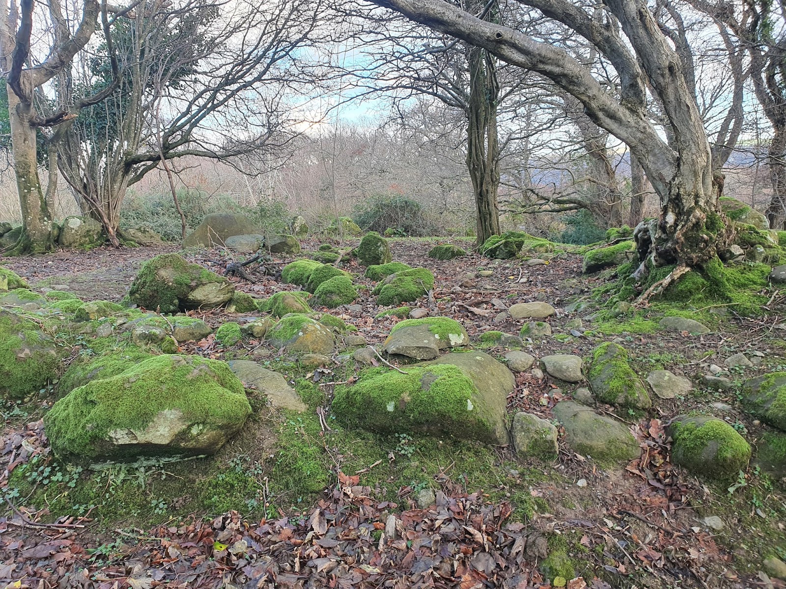
The entirety of the ruins of the house, which seems to have been roughly square. It's impossible to tell how many storeys it would have been.
 
Gatehouse first appears in the 1841 census - the first census to be taken - listed, in order, Gatehouse, Mount, Tyddyn y Wern, Pen y Graig. The order of houses up the road is Mount, Tyddyn Wern (with the gatehouse at approximately the same height up the hill), Pen y Graig. In the 1851 census the house doesn't appear, but it is mentioned in the 1861 census, in order of Tyddyn y Wern, Cottage Gatehouse, Pen y Graig. In the 1841 census the inhabitants of Gatehouse are Margaret Price, 70, and Jane Williams, 20, dressmaker. In 1861, the house is listed as uninhabited, and doesn't appear in subsequent censuses. Perhaps it was also uninhabited in 1851, and not listed. Three houses are mentioned, unnamed, as uninhabited. Interestingly, the 1861 census lists the occupation of Aaron Roberts of Pen y Graig as 'farmer of 8 acres, highway collector.' Could this be related to the demise of the gatehouse?

The famous Rebecca Riots occured between 1839-1843, in part as a protest against toll roads but also against economic conditions. These protests were mainly in South Wales, but perhaps the gatehouse fell out of use during this time due to unrest over toll charges. Another BBC article says that the 'Turnpikes act of 1844 amalgamated Welsh trusts and reduced tolls.' Perhaps the railway built along the coast in 1848 also reduced traffic coming up over the pass of Bwlch y Ddeufaen to avoid the route around Penmaenmawr. Coflein reports that until 1772 'carriages previously used the sands at low tide' to get around the headland. This is some seventy years before the gatehouse may have fallen out of use, but the road around Penmaenmawr must have been precarious even after the new road was built, as these linked pictures show. Even in our modern age it can feel very exposed at times on this coast road.

This is all speculation about a building with very little historical fact attached to it. The scant facts are that the building was known as Gatehouse, that it sits on one of the four roads up to Bwlch y Ddeufaen from the Conwy Valley, which was a drover's route and possibly the route of the Royal Mail coach, and that after it was abandoned, Aaron Roberts was a farmer and 'highway collector,' when in 1841 he was an agricultural worker. (In 1851 the census seems rather confused. The house names are not in order and Aaron isn't shown in Pen y Graig, although he may simply have not been present that day.)
 

To the left of the house a wall curves around to form a small yard. 


This really is a very small space, and presumably a lot of the stones have been robbed out for other purposes.


The wall on the other side of the track is particularly well kept near this house. Perhaps some of the house stones have ended up here?


Although in its day this house may have taken tolls from passing carts, in more recent years it has regained new life as a very exciting spaceship, and taken small boys on many trips into outer space.


Behind the house the curving yard wall continues to the stream. It's not a massive space, but a relatively good size for such a small house.


The amount of stones here suggest either another structure, or they are simply scattered from what was probably a wall to the left of the photo.


The stream which separates the house from the lane, with the modern concrete footbridge to one side.


Standing on the bridge and looking down at the flat width of the stream. The stream is shallow here, but at times of heavy rain the flow has been so strong as to make crossing the ford dangerous.


There is a single large, flat slab of stone under the water, surrounded by a reasonably intact area of cobbles. This is much easier to see in the summer, when the water is lower!


The track to the farm of Tyddyn Wern (from where the footpath leads into Rowen) is very picturesque at all times of year. Past Tyddyn Wern the footpath can be almost impassible when the bracken and brambles are high.


Looking up the lane, past the ford on the right.


Looking down the lane from the ford. Imagine this road as a track of stones and mud, and it's easier to understand why you might pay a toll to travel on a route that was better looked after.


Monday, 31 August 2020

The Lost Cottages - Turpeg Mynydd, Pentrefoelas

Turpeg Mynydd is a curious little cottage which sits right on the side of the road which winds down through the Denbigh Moors into Pentrefoelas. Comments on a YouTube video of the place indicate that the last inhabitant was an old woman, but that it's been empty for quite some time. One commenter, Ron Jones, recalls 'I can remember back in the late 50s early 60s, in the summer you would always see the man and lady who owned it sitting outside. They would always have a chat with anybody that stopped. They were very old then. The front garden and the one on the other side of the road were always in full bloom and always smoke coming out of the chimney.'

In various places it's suggested that the place was a turnpike (the name translates to 'Mountain Turnpike'), charging those using the road between Pentrefoelas and Denbigh. Coflein has the place listed as a 'possible squatter's cottage,' presumably referring to the place's origins rather than its later use, saying, 'It has the appearance of having originally been built by squatters on the mountain common.' The site only dates the cottage as post mediaeval, however, with nothing more specific. It called the place 'recently abandoned' in 2008. In a PDF leaflet, however, it states the cottage was 'built in the late 1820s.' It's certain that the building isn't in the more obvious shape of a toll house, with a three sided toll booth projecting onto the side of the road, but not all toll houses are built in this way. Perhaps this was just a more humble building.


The cottage is situated very close to the edge of the road; probably not such an issue when it was first built, but now, with the road popular with bikers and fast cars, it doesn't seem so idyllic.


The house seems to have deteriorated significantly in recent years. Many images online show the place with the window frames, if not all the glass panes, intact, lace curtains still hanging in the windows, and the door on the lean-to still in situ. (For example, this photo from 2017, which refers to the place as 'Sylvia's Cottage.') Now the windows are gone, the lace curtains mere tatters at the top of the windows, and the door to the lean-to has been kicked in. The brightness of the white front of the house has also deteriorated.


The coal bunker is hard on the road; the road tarmac is just visible to the right. The roof is gone but the walls are still intact. 


Perhaps a vain attempt to contact the occupier, but you have to give the Royal Mail their due for trying.


Inside, damp is eating away at the plaster, and has caused most of the wallpaper to slough from the walls. The floor has survived better, being made of slate slabs.


 An earlier, equally vain attempt by Royal Mail to contact the occupier.


From within, a few shreds of the lace curtain can still be seen. Considering the road outside, the view is still rather pleasant.


 The front door, which was perhaps kicked in at some point, and has been replaced with a plywood sheet, possibly indicating someone has responsibility for the property. The colour of paint and the look of the hooks on the back of the door seem to indicate a relatively recent date of occupation, perhaps in the 1990s.


The main fire, with the fire surround falling away from the wall. It seems odd that a cottage like this wouldn't have a big fire in the main room, but perhaps an earlier fireplace has been made smaller.


Some of the remaining wallpaper. Again, the design seems to point to a later occupation.


The single intact window is in the end of the cottage, with a telephone wire leading in through the frame. The panes resemble those in earlier photographs of the larger windows in the front of the house. Probably this window has survived due to being too small to climb through, and not facing the road.


A single sieve hangs from the shelf over the fire. What's striking about this cottage is that there's no sign of either kitchen or bathroom facilities inside the house, and no obvious sign of an outhouse nearby, unless one of the small buildings across the road served this function.


A small detail on the mantleshelf, a little flower at the top of each bracket, gives the place a homely feel. The plastic peg on the washing line again indicates a later date of occupation.


Plaster has fallen away from the laths of the ceiling, and also from the stonework of the wall, indicating a leak in the roof above.


The door into the second room, which has suffered far more damage than the first room. The door must have been white before being painted over with the same light purple that is on the front door and mantleshelf. It looks as if at some point someone tried to screw it closed.


This little fireplace in the second room seems to have been painted up. Perhaps the room was heated with something like storage heaters instead. Scraps of paint show the room was once bright and cheerful.


The window in the second room which, again, has lost all its glass and only has shreds of the lace curtain remaining. Something like a dog lead handle seems to be on the windowsill.


The roof has failed badly on this side of the cottage, and the damage from the weather entering is easy to see. The rot will slowly spread outwards from this breach, while wind will come in and loosen more slates.


Directly under the hole in the roof, the terrible power of water damage can be seen. Unlike the first room, the floor in this room is made with floorboards and joists, and seems quite unsafe to walk on.


A single bulb still hangs from the ceiling.


This mirror is the sole piece of furniture left in the house.


On the floor of the second room just a little wallpaper remains, in a delicate eggshell blue with flowers of pastel pink and green.


The lean-to provides a little extra space for the house. The door has been kicked in and the window is no longer glassed.


Again, some of the signs in the electrical wire and plastic washing line indicate a later date of occupation.


The doorhandle on the kicked in door is a rather lovely piece of metalwork. The peeling layers of paint are rather beautiful.


The lean-to window offers a bleak, if impressive, view across the moors.


Outside the lean-to, behind the house, is the indication of the possibility of some kind of structure existing at some time.


Hard to see under rubble and dirt, the floor of the lean-to is made up of quarry tiles.


 On the other side of the road are two small outbuildings which appear to be in good order.


The inside of the coal bunker, with the small hole just visible at the bottom for accessing the coal. This coal would be much needed through the winter on the Denbigh Moors.


The end of the house has been pebbledashed down to a point, but the indication is that there used to be some structure against the end wall here. Every photo online seems to be of the cottage from the front or the other end, though, so there's no way to see if there was a structure in earlier photos.


The bleak moorland, stretching away behind the cottage.


With the vandalism of recent years and the start of damage to the roof, it seems likely that this cottage won't be intact for long. Such a small place in such an isolated location doesn't seem to have much hope of rescue. Perhaps one day a rich recluse will come along, and save it from ruin.