Hafod y Cae sits in a rather inaccessible location amongst the trees and undergrowth on land up above the Afon Roe where it tumbles down into the valley past the side of Tal y Fan. It's probably more sensibly approached from the road on the north side. Never sensible, I fought through tangles of brambles and woodland growth and down and up steep slopes from the southern side of the river, since I was walking along the footpath in that area at the time.
The deep valley through which the Roe flows is beautiful, though, and a pleasure to fight through. I felt as though I had stepped into another world, far from human impact, where the only signs of human activity were ruins. In the bottom of the valley was a ruined little sheepfold. The hafod sat some distance away, where the slope rose up again towards Tal y Fan.
There are very few references to this obscure, almost entirely eroded, little hafod online. Many hafodau were later turned into year-round dwellings, but it's possible that this little place never was, and fell into disuse sooner than some of the others. It's certainly very small and shows no sign of improvement in the form of outbuildings, pens, or a small garden. There is a mention in the 1846 tithe lists of 'Hafod y Gael,' shown on the map in the same approximate location as Hafod y Cae (at approx SH 7429 7107). The place is described as 'Pasture, Wood,' and the Landowner and Occupier are both the same George Davies, Esq. The land is 28 acres, 31 perches, and the tithe charged for this is 13 shillings. It seems quite possible that this is the same 'Hafod y Cae,' and it is misspelled either on the Ordnance Survey maps or on the tithe map.
I found a single reference on a blog mentioning the place obliquely, which I reproduce without alteration: June 21st 1907 Indenture between Geroge Randolph Ashley, William Epworth Cowpland, Harry Rathbone Griffith of Tanyronen Portmadoc, Physician and Surgeon, and John Blackwall of Hendre Llanrwst, Supplemental to the before absstracted Indenture dated 19 December 1882 and reciting that a sum of £3,000 ... by the Settlement paid to the said George Randolph Ashley and Alice Louisa Ashley his wife secured by mortgage of Glandulyn Ffynnon Bedr and Hafod y Cae in the County of Carnarvon and Beaver Grove in the County of Denbigh.

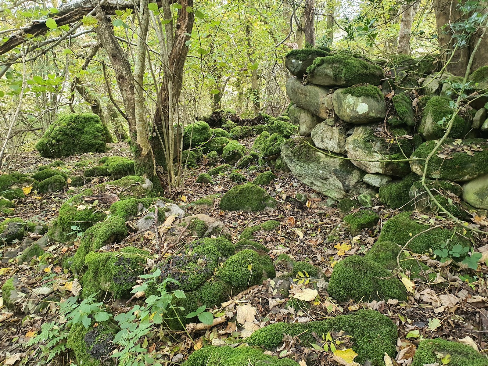
Very little remains of this hafod, and the stones are so moss covered that they blend into the ground. There seems to be a sign of a doorway in the centre of the photograph.

This wall is the highest the remains get, at about three feet.

From behind, the walls are gone almost to the ground.

From the other side, there aren't any signs of windows or doors. I can't be sure now of the orientation of the building. I felt that this was the north side but it may not be. Many of these properties up here on the mountain, when built along an roughly east-west alignment on the south side of a slope, have their windows and doors facing south.

Looking from the inside towards the front. Is this a doorway, blocked up, or just lines in the wall? The structure is very hard to decipher. More experience, or archaeological excavation, would no doubt reveal more.

If this hafod ever did have a proper fireplace, I would guess it was here, where the large amount of tumbled stone implies something more substantial than the walls alone.
At the end of the house there appears to be the remnants of an enclosure, although this could just be rubble from the walls.

Although the place is surrounded with trees, the name, 'Hafod y Cae' ('cae' meaning 'field') would imply that the land was more cleared when the place was used. A scant sentence from an academic article (I would dearly love to read the whole but it would cost me £30 to access) says 'Some scrub on the valley sides was cleared to create summer grazings, for example Hafod y Cae, Hafod y Clawdd near Rowen.' Perhaps, then, this area moved between being cleared and overgrown through the years.

The possible doorway from inside the house.

This area is no more than a pile of stones.

Nature has so taken over that it's hard to visualise this place as an intact dwelling.

A closer look at the probable doorway from outside.

More ferns and tree roots push up between the rocks in front of the house. There might be something of a trackway here, with large stones to the left forming a wall and the house forming the right side of the trackway.


Absolutely fantastic
ReplyDeleteThank you :-)
Delete